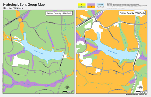
Civil and environmental engineers are noticing some unintended consequences of the updated Fairfax County Soils Map (See Field Notes, Vol. 19 No. 4). These include:
• Certain existing Stormwater Facilities may now be too small to accommodate all of the development planned in their watershed, and;
• Some Allowable Stormwater Runoff rates have increased using the new soils map vs. the old soils map.
In developed areas that were previously mapped, the new soils maps typically reflect that the original soil profiles have been disturbed by grading. This increases its run-off rate characteristic due to compaction and removal of the upper, more well-drained, portion of the soil profile. In such situations, the new NRCS Soil Survey for Fairfax County shows areas in which the Hydrologic Soil Group1 has shifted one or more groups (e.g. C to D) to higher runoff potential. (See Figure 1 below) |