|
| Vol. 23, No. 3 |
May 18, 2015 |
|
|
Stricter Battlefield Protection Demands Rigorous Studies
|
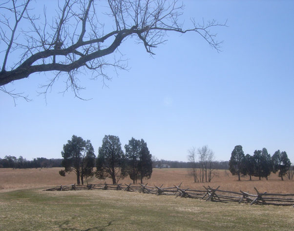
Historic preservation agencies are increasingly concerned with protecting Virginia’s Civil War battlefields from encroaching development and are demanding more rigorous cultural resource work for any project in review for a federal action, therefore any project needing a wetlands permit. WSSI’s Thunderbird Archeology division can work with you to locate these mapped battlefield sites and bring your project’s cultural resource work up to the current level of detailed study required in the permit process.
These hot spots – battlefields mapped by the National Park Service’s American Battlefield Protection Program (ABPP) – encompass significant acreage in northern Virginia, including:
|
|
29,105 acres in Prince William County, |
|
18,579 acres in Loudoun County, and |
• |
5,861 acres in Spotsylvania County |
Many are located areas of potential growth: along the I-66 and Route 29 corridors near Manassas, Gainesville, and Haymarket in Prince William County; the vicinities of Leesburg and Middleburg in Loudoun County; and the Fredericksburg area in Spotsylvania County. ABPP-mapped battlefields also ring many Virginia cities including Richmond, Petersburg, Suffolk, Winchester, and Lynchburg.
The Virginia Department of Historic Resources (DHR) now requires more detailed studies in ABPP-mapped Battlefield Core and Survey Areas for any project in review for a federal action, therefore any project needing a wetlands permit. DHR’s policies for evaluating historic battlefield environments are consistent with those of the National Park Service.
Metal Detecting
Metal detector surveys are now required by the DHR in all ABPP-mapped Battlefield Core and Study Areas. This policy applies even to those studies conducted prior to DHR’s October 2011 establishment of Guidelines for Conducting Historic Resources Survey in Virginia, which included new Special Environment survey methods for military sites. According to those guidelines, sites likely to contain Civil War-era military resources (i.e., battlefields or encampments) need metal detector surveys in addition to standard Phase I shovel test pits.
More stringent preservation measures are also being implemented at the local level. Justin Patton, Prince William County’s Planning Archaeologist, recently indicated that he will adhere closely to DHR guidelines and no longer consider limiting metal detector surveys that are conducted in compliance with county cultural resources review. Therefore all cultural resource work for a site slated for development must be re-evaluated to determine if it will meet current standards. WSSI’s Thunderbird Archeology division staff can work with you to locate these mapped battlefield sites and bring your project’s cultural resource work up to the current level of detailed study required in the permit process.
More Detailed Study Grid
Metal
Detecting on a Phase I Military Site is labor-intensive. DHR’s 2011 guidelines recommend a 25-foot transect grid (reduced from the standard 50-foot grid). Additionally, DHR will require metal detector survey of all portions of a battlefield property that have not been disturbed or inundated.
Battlefield Landscape Analysis
Reviewing agencies may request additional research and analysis, in addition to the more rigorous survey methods. DHR’s 2011 Guidelines recommend implementation of KOCOA, an analytical technique derived from military science that focuses on primary source accounts of the battle and key battlefield landscape features, and involves interpretation of:
|
|
K: Key Terrain (i.e., terrain that must be taken or held to achieve victory);
|
|
O: Observation and Fields of Fire (i.e., terrain that allows for observation and targeting of enemy movements and avenues of approach); |
|
C: Cover/Concealment (i.e., terrain that provides troops with protection from enemy fire); |
|
O: Obstacles (i.e., terrain or landscape features that limit troop movements or control of key terrain); and
|
|
A: Avenues of Approach/Retreat (i.e., terrain through which troops move against or away from the enemy forces) |
How does this impact a project?
The additional archival research and landscape analysis, up to and including KOCOA analysis, can also be time consuming and expensive. Furthermore, based on the results of such research, an ABPP-mapped site may be eligible for the National Register of Historic Places as a historic cultural landscape – even without recovery of Civil War-period military artifacts. In that case, any site development will have a direct effect on a National Register-eligible resource, and obtaining a wetland permit will typically require intensive coordination with federal, state and local agencies and interested public parties, the execution of a Memorandum of Agreement, and mitigation for the impacts.
Thunderbird Archeology has the experience and knowledge to guide your projects through these stringent cultural resource requirements and potentially challenging outcomes. Our staff has conducted metal detector surveys of numerous sites in ABPP-mapped battlefield lands in Prince William County for public and private sector clients in accordance with the 2011 DHR guidelines. These studies were required by the Prince William County Planning Archaeologist pursuant to local land-use or facilities review decisions. Thunderbird also has extensive experience working with DHR and the National Park Service, performing in-depth battlefield assessments, and battlefield viewshed studies. Civil War battlefields previously studied by Thunderbird include Manassas I, Manassas II, Bristoe Station, Buckland Mills, Brandy Station, Thoroughfare Gap, Manassas Station Operations, Salem Church, Fredericksburg I, and Fredericksburg II.
|

|
| To discuss how these requirements may impact your project, please contact Boyd Sipe or John Mullen. |
|
|
|
|
 |
|
|